Bobinas P4G
  • Login
  • Public

    • Public
    • Groups
    • Popular
    • People

A map of the Coast Starlight route, as described in the Toot. It hugs the coast from LA to San Jose before meandering inland up to Portland and Seattle. An attribution to OpenRailwayMap.org is also included.

Download link

https://media.mstdn.social/media_attachments/files/108/257/102/140/204/146/original/dd1a9d4c71eee373.png

Notices where this attachment appears

  1. Thomas Connor (thomasconnor@mstdn.social)'s status on Saturday, 07-May-2022 06:50:25 UTC Thomas Connor Thomas Connor
    in reply to

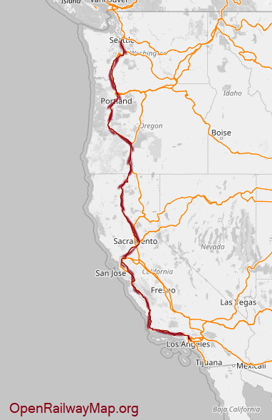
    So a week ago I decided to check off a bucket list item and took the #CoastStarlight all the way from Los Angeles to Seattle.

    For those of you with better things to do than to keep track of #Amtrak routes, the Coast Starlight is the West Coast's only long N-S route; starting in LA, it steps north to Burbank before cutting to the coast at Oxnard. It then hugs the coast to San Luis Obispo, cuts inland into the Salinas Valley, and heads north before joining the Santa Clara Valley near Gilroy. Then the East Bay through Oakland, over the Carquinez Strait to Sacramento, north past Mt. Shasta and into Oregon, over the Cascade Range to Eugene, and then up the Willamette Valley to Portland. Finally, the train shadows I-5 toward Olympia, then to Tacoma and Seattle.

    In short: it's a grand tour of the Pacific Coast of the US! And this full ride takes about 36 hours, so there's plenty of time to appreciate the sights.

    In conversation Saturday, 07-May-2022 06:50:25 UTC from mstdn.social permalink
  • Help
  • About
  • FAQ
  • Privacy
  • Source
  • Version
  • Contact

Bobinas P4G is a social network. It runs on GNU social, version 2.0.1-beta0, available under the GNU Affero General Public License.

Creative Commons Attribution 3.0 All Bobinas P4G content and data are available under the Creative Commons Attribution 3.0 license.