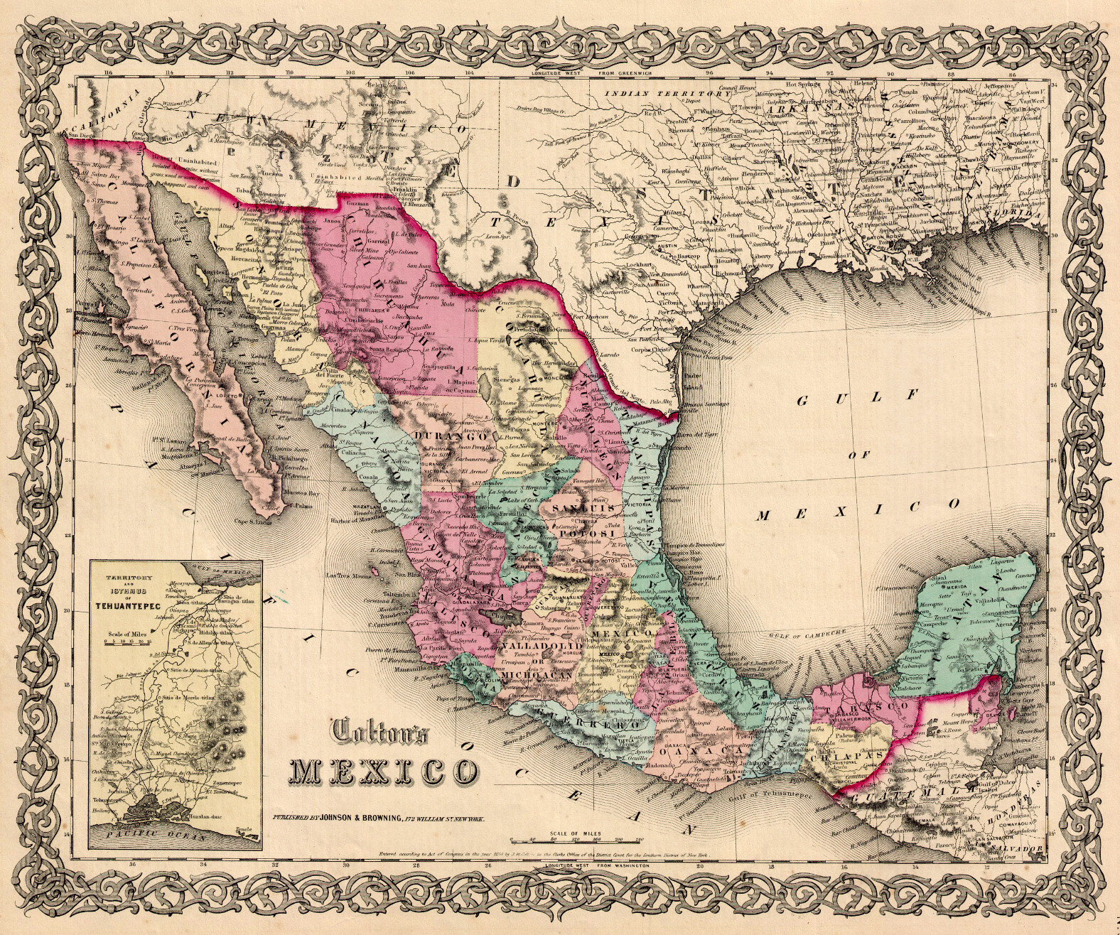
A hand colored map for the nation of Mexico with an inset for the cross-isthmus route connecting the Pacific and Gulf of Mexico.
https://cdn.masto.host/sciencemastodoncom/media_attachments/files/110/452/971/246/037/447/original/0aa1c620d0000b35.jpeg
Beautiful map for Mexico from a notable American mapmaker, Colton. But there's an interesting notation north of the border, showing the territory of Arizona as it ran east-west along the border, with New Mexico above it. #map #maps #Mexico #arizona
Bobinas P4G is a social network. It runs on GNU social, version 2.0.1-beta0, available under the GNU Affero General Public License.
![]() All Bobinas P4G content and data are available under the Creative Commons Attribution 3.0 license.
All Bobinas P4G content and data are available under the Creative Commons Attribution 3.0 license.